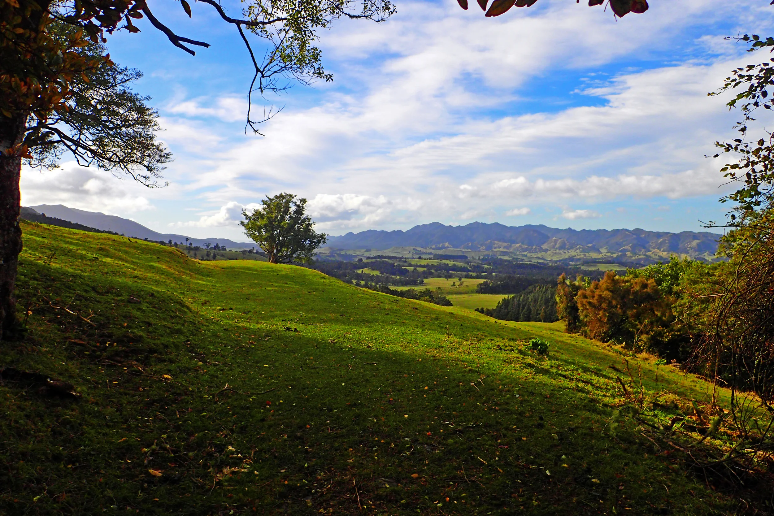
A biting chill set in as we tucked into our tent for the night on the first day of our 2 day hike in the Tongariro National Park. I shivered most of the night despite my 10 layers of clothing, sleeping bag and silk liner. I am surprised I managed even 3 hours of sleep between the cold and the pain in my feet from the tendonitis and blisters I developed during the day’s hike.
In the morning, I was simultaneously dreading and looking forward to the walk ahead. We would be reaching the highest peak at the Red Crater where outstanding views awaited us. The views turned out to be more spectacular than I could ever have imagined!
The surprise of the landscape was the perfect distraction from my aching feet. But my excitement got the better of me—an additional hike up the Tongariro summit led to my utter defeat.
Lava formations in the Oturere Valley
Beginning at 8 am, we set off up the hill next to the hut. The short climb took us onto a flat plain littered with huge lava formations from early eruptions of the Red Crater. Like a volcanic graveyard, ashy tombs towered overhead as I navigated between them.
Harald and Marek stopped to take photos of the formations. Anticipating I would slow them down later in the day, I chose to go on ahead. Soon, I passed the last of the lava flows and entered an enormous, empty plain stretching out from the track like a desert highway with mountains on all sides.
I was like a speck of dirt at the center of a dry, dusty gutter. The light, thin line seen going across the center of the valley in the following photo is the path I walked.
I dragged my feet across and met the craggy incline on the opposite side. We were only about an hour into the second day when I began the first major ascent, with Harald and Marek only halfway across the valley behind me.
An Emerald surprise
The ascent was a bit of a rock scramble. As I went up and up, the Kaimanawea range and Rangipo Desert made for a beautiful, low-level prequel to the expanded view I would see later.
The air smelled slightly of sulfur and the ground started to pump hot steam out of the rocks to the left of the trail.
By two-thirds of the way up, I was running out of water. Harald had the refill bottles in his pack and they were still only about a third of the way up the incline at this point. Luckily, the melt from the snow was flowing down the side of the cliffs next to the trail. This refreshing, icy cold run-off rejuvenated me for the last portion of the climb.
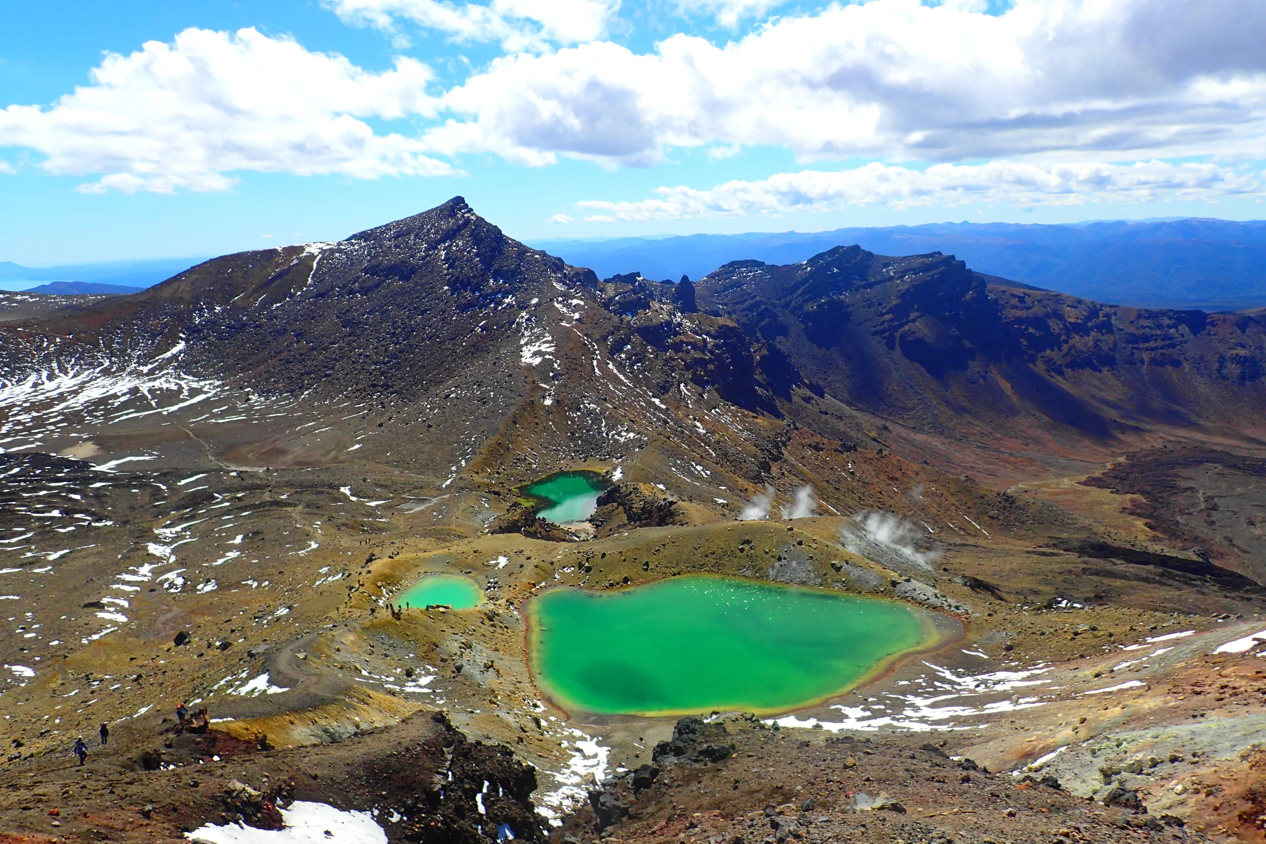
As I reached the top, I saw a Volcanic Hazard sign alerting hikers they were entering an eruption area. I was immediately distracted by what lay behind the sign—a huge pool of bluish-green water.
The color is the result of thermal minerals washed down from the Red Crater above. I had never seen water this color before.
With the landscape of the last 24 hours being mostly dry, volcanic plains, the Emerald Lake was an extremely welcomed surprise. And more surprises were just ahead!
To the Red Crater
I circled the lake and sat down next to it in awe. I wanted to wait for the guys in order to see their reaction. After about 20 minutes, Marek peered up over the hill and took in the surprise. We walked together to discover the Emerald Lake was actually Lakes; one of the smaller ones among 3 in total.
Marek and I walked to the base of the steepest climb of the day: the final 186 meters taking us to the red crater. The walk up was tough because the narrow path was made of loose silt. Trudging up 3 paces meant sliding back 2—but the view!
There was snow sprinkled mountains all around, valleys to the right and left, Emerald lakes behind, and the Red Crater, Mt. Tongariro, and Mt. Ngauruhoe ahead. Everywhere we looked was a breathtaking sight. But I was absolutely obsessed with those lakes. I still cannot get over them—the color!
Reaching the summit at 1886 meters above sea level, I felt so fulfilled by the views I didn’t even care about my aching feet. “This is what I came across the world to see.” I thought to myself. “This is New Zealand.”
I had a seat on a boulder at the summit and gazed around me as I gobbled down a mushed peanut butter and jelly sandwich. Peanut butter and jelly never tasted so good.
Behind me was part of the Red Crater covered in snow. When the snow melts away, the red crater’s shape and hue make it look like lava flowing over it, frozen in time. I was lucky enough to see it in both forms—with and without snow—because I returned to do the Tongariro crossing (about 19 km from one side of the park to the other) with a friend a couple of weeks later. Here it is—spectacular in both forms:
From up there, I could also glimpse the Blue Lake—another lake far in the distance only seen up close if hiking the crossing. Here it is up close from when I did the crossing:
A slight descent down the other side of the Red Crater peak led to a wide ridge filled with snow. Many people were lingering there having snow-ball fights and building snowmen. These activities felt pretty unusual with the sun blazing overhead standing in the middle of a volcano range!
Mt. Tongariro Summit
Mt. Ngauruhoe and Mt. Tongariro both have reachable summits as extra, side trips from the main circuit walk. We all wanted to climb Mt. Ngauruhoe, if not for its significance as Mt. Doom in the LOTR films, then for the fact we had been circling it for the entire hike.
The problem was we still had at least 4 hours ahead of us and none of us were feeling well enough to ascend and descend an additional 400 meters in elevation. Instead, we opted to do the Togariro summit, less than 100 meters elevation and just 1.5 hours to complete.
Most of the Mt. Tongariro summit hike was on a slight incline along a very steep ridge. The danger was the slippery snow as we walked along the ledge.
At 1,967 meters up, the views from the summit were gorgeous. We had views of the entire Mangatepopo valley and beyond. The day was so clear we could make out Mt. Taranaki—another volcano—over 200km away to the West coast.
1200 meters down Devil’s Staircase
The way back from the summit was very slow for me. Apparently, the extra climb up Mt. Tongariro had pushed my feet into a whole other category of pain. From here on, I was left far behind the guys wincing at every step.
Eventually I made it back to the snow playground on top of the Red Crater. The climb down from there led into a wide, barren valley. I could see people walking the path far below—tiny ants marching in front of an enormous ant hill—Mt. Ngauruhoe.
The descent was a challenge for anyone even without foot pain. Part of the track even had a chain pinned to the craggy lava rocks for support on the way up or down.
The guys waited for me at the bottom and we made our way across the valley together. I was a wreck by the time we reached the stairs taking us down the Mangatepopo saddle—aptly nicknamed “Devil’s staircase.” My 8 blisters felt like hot coals in a blender with razor blades pressing against my heels and toes.
Harald and Marek sped on ahead of me while I took each of the hundreds of steps both feet at a time. I felt like a crooked geezer as several elderly and older adults whizzed past me down the stairs with their hiking poles firmly planted. I told myself they had probably spread out the circuit course across 3 or 4 days like the woman at the information site had said people usually do.
Acknowledging my limits
At the bottom of the main set of stairs, a group of people noticed me struggling. They offered me some blister band-aids and helped me put them on. The band-aids wouldn’t help much, but I gladly accepted the friendly support.
They suggested I get off the track early at the Mangatepopo car park instead of going the extra 3 hours from there back to Harald’s car at Whakapapa village. As much as I wanted to finish the entire circuit—I knew they were right. Blisters aside, the tendonitis pain felt like I had split my feet in half at the balls of each foot. I decided to be smart and accept the limits of my body. I had to admit I had reached my limit.
It took me twice as long as the projected time on the park signs, but I finally reached the lot. By the time I arrived, the sun was setting and Harald and Marek arrived just 1.5 hours later with the car.
They were in bad shape by then, too. All of us could barely walk. We were limping and dragging our feet around like I had done on the streets of Chiang Mai dressed as a zombie for Halloween.
Looking back, I’m not disappointed I didn’t actually finish the circuit. I pushed myself to do the circuit in 2 days and went the extra hike to the Mt. Tongariro summit. I pushed my body as far as it could go and I was happy to finish early.
In the end, the pain turned out to be completely worth it. I was—and still am—completely captivated by the Tongariro National Park. In fact, I loved it so much I ended up returning two more times!
Read the previous installment, The Toughest Hike I’ve Ever Done: Day 1 of the Tongariro Northern Circuit.